Background
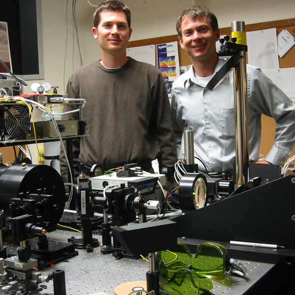
An article in the Summer 2004 UCAR Quarterly describes how REAL got started. A description of conditions at NCAR resulting in the closure of the REAL program there can be found in an August 2008 article in Science by Eli Kintisch. The Fall 2009 issue of Inside Chico State describes how REAL came to Chico State. In September of 2012, the Atmospheric Lidar Research Group received second generation real.
How does it work?
Four refereed journal articles and two US patents (7583364 and 7580127) describe the key aspects of the REAL. Briefly, it uses very short pulses of invisible, eye-safe, near-infrared electromagnetic radiation in much the same way as weather radars use pulses of microwave radiation. The wavelength of near-infrared radiation, approximately 10,000 times shorter than microwaves, makes the lidar sensitive to suspended particulate matter (aerosol particles: dust, smoke, pollen, and haze particles).
Just as radars can tell meteorologists where it is raining and snowing, the lidar can be used to locate clouds of particulate matter. In fact, because the lower atmosphere is usually rich with aerosol from both natural and man-made sources, the lidar almost always detects signal from "background aerosol". By sensing variations and movement in the background aerosol, the REAL is capable of revealing atmospheric circulations and phenemona that are difficult to observe using traditional methods. The key strength of REAL is the power of the images and animations to show spatial structure and evolution of "clear" atmospheric flow.
Why?
Traditional meteorological observations are made at a point in space over time. Consider for example the time series from a thermometer or anemometer. If the sensor is moving (for example attached to a balloon or airplane) we can obtain data over a line (1-dimensional) in space. Two and three-dimensional spatial observations of the atmosphere are much more difficult to obtain. By pulsing electromagnetic radiation, and scanning quickly, radars and lidars offer the ability to observe the 2-D and 3-D structure of the atmosphere.
One popular approach to conducting atmospheric research is by simulating atmospheric phenemona in a computer. The REAL can be used to provide observations to test atmospheric models. This is how we build confidence that a model is accurate and providing the right answers. One example of how elastic backscatter lidar data can be used to test a model can be found in Mayor et al. 2003. Other examples can be found in Sullivan et al. 1998 and Doyle et al. 2009. In the future, we will create algorithms and software to extract quantities from the REAL data to make atmospheric model validation easier.
In addition to observing atmospheric structure and dynamics via the "background aerosol", the lidar can also be used to observe the transport and dispersion of particulate matter near the sources. For example, emissions from industrial stacks and mining operations. The lidar can be used to provide direct, precise, real-time location and heading of aerosol plumes. This information can be used to test disperson models and even warn the populations downstream of release sites as well as take low-regret protection actions such as shutting ventillation intakes.
Where?
The REAL is currently located in Chico, California. It has been deployed at the following locations: Washington D.C. (May 2004); Dugway UT (Oct. 2004, June 2005); Albuquerque NM (Sept. 2005); Independence CA (March 2006), and Dixon CA (March 2007). The REAL can be transported to anywhere accessable by tractor-trailer. It requires a clear line-of-sight to operate.
Future work
Many excellent research opportunities exist to apply the REAL in atmospheric science as well as make it more useful, easier to use, and less expensive. The immediate top priority is to develop algorithms and software to automatically extract quantities from the images such as vector flow fields, boundary layer height, and the location of features such as micro-fronts and aerosol plumes. Projects are available for students of almost all majors and educational levels.
System specifications
- Wavelength: 1.543 microns (Near-IR, Telecommunications C band)
- Pulse energy: 170 mJ
- Pulse rate: 10 Hz
- Pulse duration: 6 ns
- Beam diameter:
- At 0.0 km range: 66 mm (based on 1/e2 points in beam profile)
- At 1.6 km range: 0.5 m
- At 6.0 km range: 1.5 m
- Beam divergence: 0.12 mrad (half-angle)
- Receiver field-of-view: 0.54 mrad
- Telescope diameter: 40 cm
- Detector type: InGaAs APD
- Analog to digital converter sampling rate: 100 MHz
- Analog to digital converter resolution : 14 bits
Credits
The REAL, developed at National Center for Atmospheric Research (NCAR) between 2001 and 2007 with funding from the National Science Foundation (NSF), is presently maintained and operated at the California State University, Chico. The CSU Chico College of Agriculture and University Farm host the lidar. Dr. Shane Mayor manages the project with help from the College of Natural Sciences and grants from the National Science Foundation.